
Expert: Satellite images show mining, not prospecting at lanthanide site
 Geraldine Tong
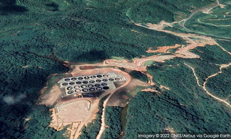
The structures depicted in the satellite imagery of a site in Hulu Perak near Gerik are for mining operations, not for identifying whether there was rare-earth at the site, said environmental and forestry researcher Lim Teck Wyn.
“Your satellite images do indeed show the pregnant solution pond structures.
“These structures look to be...
Verifying user
RM12.50 / month
- Unlimited access to award-winning journalism
- Comment and share your opinions on all our articles
- Gift interesting stories to your friends
- Tax deductable